Informations
Solution ID
Description of solution
The Skurdalsåa River is one of many steep tributary rivers to the main river Gudbrandsdalslågen. The river has its outlet from an old dam (1870) in Lake Svintjønna , high in the catchment, and it is ca. 7 km from the lake to its confluence with the main river. The total catchment is about 15 km2 , consisting of farmland, wetlands, small lakes, and mountain landscapes ranging in altitude from 200 to 1030 m asl. The catchment of the lake at 958 m asl. is only 3.2 km2. Due to the relatively small catchment, Skurdalsåa responds rapidly to precipitation and snow melt. Roads, houses, a school, a kindergarten, and a sports facility are situated adjacent to the lower part of the river. The infrastructure has experienced repeated flood damage in recent years.
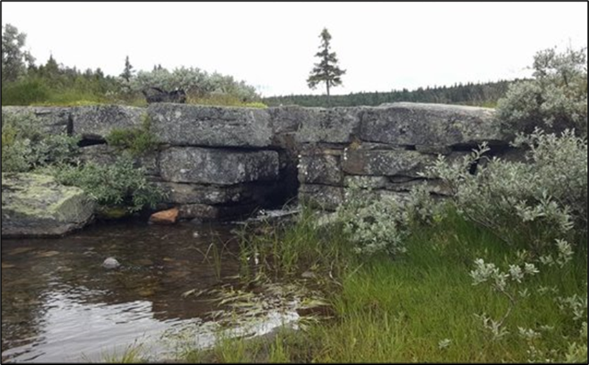
Through the H2020 project PHUSICOS an old dam has been modified in order to reduce the peak flood.
The implemented NBS has utilized the old dam (made of local stones, initially built for household water and irrigation purposes) to retain the flooding. The dam is modified by a modest increase of the dam height and lowering the discharge gate, and reinforcing the dam. The spillway is improved and extended. Hydrological calculations reveal that the proposed measures can retain and evenly distribute the peak flood for 48 hours (in a 200-year flood event).
The ownership of the lake and the dam, are shared between 6 of the local farmers. The local farmers have carried out parts of the work, in addition to a local construction company.
Potential co-benefits:
- increased sense of safety for the inhabitants along the river.
- less potential for damage caused by floods to the valuable river environment
- continued (and improved) the possibility of using the lake for irrigation purposes downstream.
Regulations are important to consider, and may cause project delays.
Keywords
Exposition
Activity
Actors
Through the H2020 project PHUSICOS an old dam has been modified in order to reduce the peak flood.
The ownership of the lake and the dam, are shared between 6 of the local farmers. The local farmers have carried out parts of the work, in addition to a local construction company.
Temporal aspects
Others
https://phusicos.eu/case_study/valley-of-gudbrandsdalen-norway/