Pyrenees
THE PYRENEES, IN SPAIN AND FRANCE
The Pyrenees is a mountain bioregion that is particularly vulnerable to the effects of climate change. In general, mountainous regions are places with great ecosystem diversity in which, sadly, the average annual temperature is increasing faster than the global average. Climate change has a tremendous impact on biophysical and socioeconomic systems like flora, fauna, water resources, energy, and tourism, as well as farming and grazing.
It appears that in the future, the Pyrenean territory could face an increase in minimum and maximum temperatures, heat waves and drought episodes; an increase in the frequency of occurrence of intense rain episodes and the intensity of hail episodes; the increase in the risk associated with floods, even if there is no clear signal on the future evolution of their frequency of occurrence and intensity; and the weakening of the stability of slopes and rocks, in proportions that are not well known but that could result from the combination of future changes in precipitation, temperatures (fires) and the probable melting or degradation of permafrost[1].
In the Pyrenees as well as other European mountains, studies have indicated that landslides and subsequent flooding have decreased in places where forest has conquered past grasslands, especially in the highest part of pastures. In some cases, reforestation has demonstrated its usefulness to cope with hydro-climatic extreme events by reducing the hazard intensity. However, this positive impact is very local and more importantly it does not include the broader implications of socio-economic impact of land abandonment and downsizing of pastures.
The Consortium Working Community of the Pyrenees (CTP standing for Communauté de Travail des Pyrénées) and its Pyrenean Climate Change Observatory (OPCC standing for Observatoire Pyrénéen du Changement Climatique) are reaching out to local communities in these vulnerable natural areas to engage them in meaningful dialogue to co-design strategies, funding schemes, monitoring systems, services and policies related to various Nature-Based Solutions.
SITES OF THE DEMONSTRATOR CASE IN THE PYRENEES
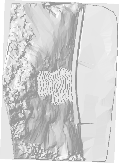
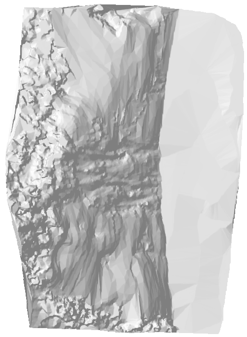
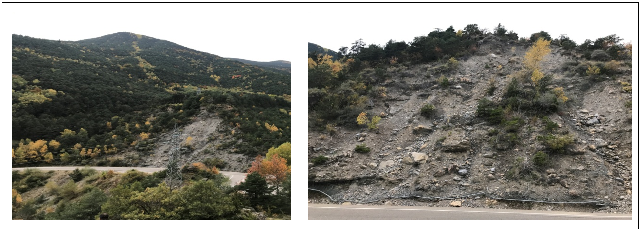
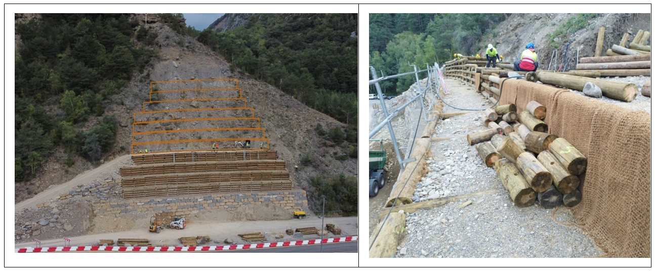
1. Rockfall and erosion at Santa Elena, Spain
In Santa Elena, landslides and rockfall from a steep, 25 m high slope consisting of loose glacial till, threaten an important road between France and Spain, the A-136. There are often fallen rocks and debris on the road and the visibility for the cars coming from both directions is low due to the curves, while the speed is often high. This location has been identified as a high-risk spot on this road. Increased heavy rain episodes may increase the hazard.
The measures implemented consist in reshaping the slope through terracing techniques, with the establishment of vegetation to stabilize the sediments, together with a drainage system to prevent water to erode and reduce stability of the slope. The terracing is being done with wooden gabions, destined to ensure a balanced, stable slope profile, with the less impact as possible. Only locally adapted plants are being used.
For direct access on monitoring webcam in Santa Elena, download the windows version or the APP and so have a look on the works going on (https://reolink.com/software-and-manual/). Then, you can add the device, user and pass as following:
- UID: 95270003P0ME1567
- User: admin
- Password: 123456
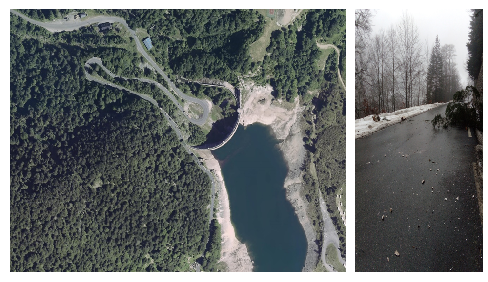
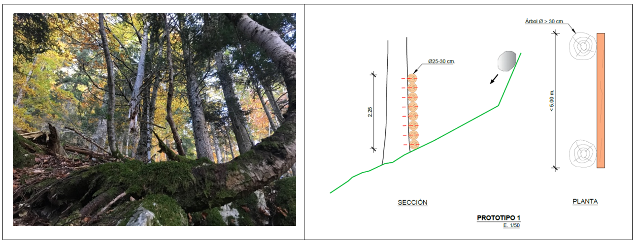
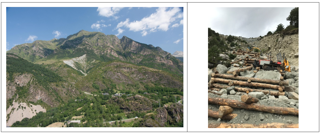
2. Rockfall at Artouste, France
In Artouste, the road, RD-934, bends around sharp hairpin turns below a steep, forested slope. The slope has several steep ledges from where rocks are released. The forest has a protection role on smaller blocks, but rocks often hit the road. In 2013, a fatal accident occurred when a passing car was hit by a falling rock.
The proposed measures consist of wooden structures designed to prevent release of rocks, and to stop released rocks before they reach too high velocity. The structures should be built as close as possible to the potential release areas and immediately below. Logs from the region will be used and the measures will be combined with the preservation and maintenance of the forest and its protection role improvement.
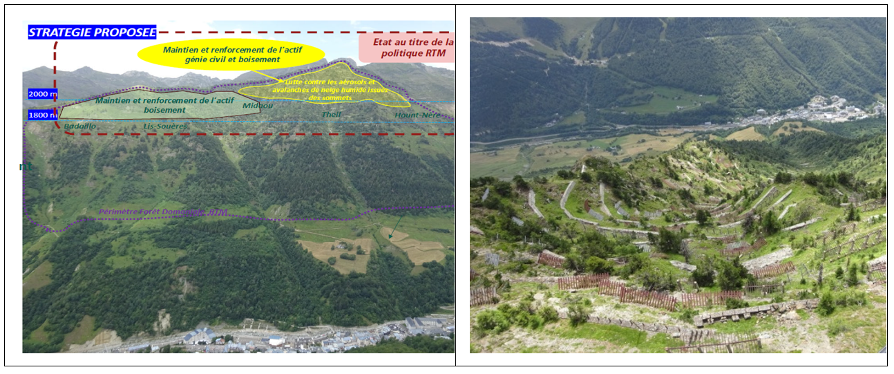
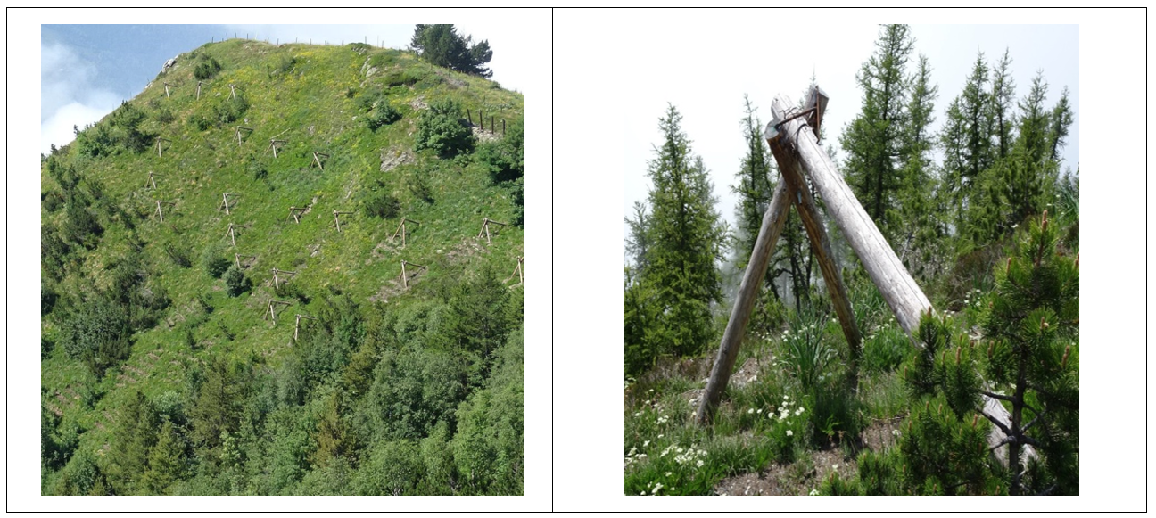
3. Snow avalanches at Capet Forest, village of Barèges, France
The village of Barèges, an important tourist destination, has been hit by snow avalanches, from the mountain side to the north of the village, several times. The village, which is part of the Grand Tourmalet ski destination and has warm health baths, was evacuated because of avalanche hazard as late as in 2013 and 2015. There are several avalanche paths in the valley side. Many measures exist, fences and barriers, and do function but in extreme winters the existing fences are buried in snow and avalanches can be released from the snow pack above the fences. This was the situation during the last avalanche that reached the village. In addition, these infrastructures are getting old and require extensive maintenance.
The NBS strategy currently implemented in Capet site consists in afforesting the release area of Midaou, one of the known avalanche paths. The plants are being protected by wood tripods until they are 4-5m high and can then stabilize the snow pack. Until then, the tripods will also have some stabilizing effect on the snow. The plants are carefully selected and adapted to the region and the altitude.
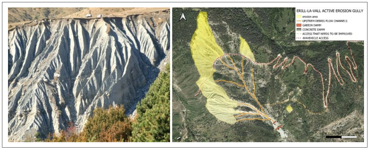
4. Debris flow measures at Erill-La-Vall, Spain
The village of Erill-la-Vall in Boi valley is heavily affected by debris flow problems, where sediments are fed from tributary creeks and into a main debris flow channel leading to the village. The source area consists of thick deposits of glacial till. The measures to be implemented here consist of a combination of revegetation, to limit erosion, and constructions of logs from local wood to minimize energy in the creeks, all to reduce the feeding of sediments to the main debris flow channel.
[1] OPCC-CTP (2018). Climate change in the Pyrenees: impacts, vulnerabilities and adaptation. Knowledge bases for the future strategy of adaptation to climate change in the Pyrenees.